Community Corner
West Hartford History: What Is Happening in This Image?
Test your knowledge of West Hartford history with this photo from the archives of the Noah Webster House & West Hartford Historical Society.


If you think you know the answer or have a special memory related to the photo, respond in the "Leave a comment" box below this article. We'll run the answer next Monday, along with a new historical photo. The image has been provided by the Noah Webster House & West Hartford Historical Society. For more information on the museum's collection and programs, visit www.noahwebsterhouse.org.
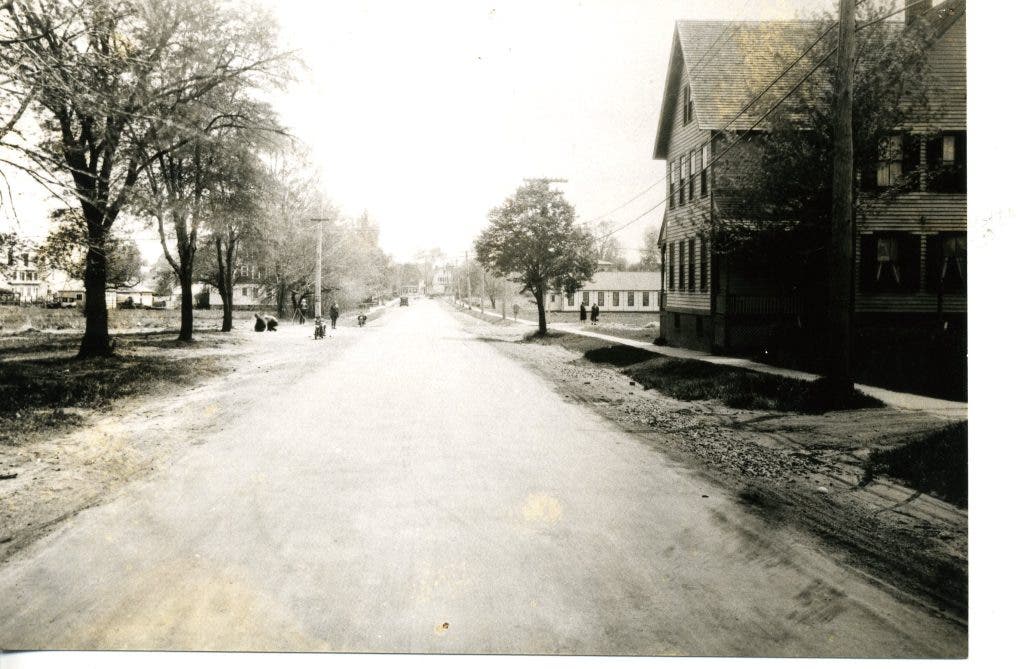
Last week's question was "What Street Is This?" Kyle, who said he really likes these old photos, used clues he found in the image to try to determine where it was. "I don't know where this one was taken, but there seem to be some clues to work with. First, the very flat topography, which narrows the possible location within West Hartford considerably. It also looks like the street we're looking down ends at an intersection at the center of the photo – there appear to be two houses that would prevent the street from continuing."
Phil Cohen provided the straightforward answer: "South Quaker."
Find out what's happening in West Hartfordwith free, real-time updates from Patch.
Phil, you're right. The official answer from the Noah Webster House & West Hartford Historical Society is: "This view is of South Quaker Lane looking south towards the Boulevard. Laid out in 1774, Quaker Lane was so named because it led parishioners through the fields to the first Quaker Meeting House."
Get more local news delivered straight to your inbox. Sign up for free Patch newsletters and alerts.