Sports
A 'Secret' Bike Route Through West Hartford
West Hartford Bicycle Advisory Committee Chairman Scott Franklin shares 'Discover West Hartford by Bicycle,' a route he mapped out which incorporates some rights-of-way and a park you may never have noticed before.

There are many ardent bicyclists in West Hartford.
That was clearly evident at Monday night's meeting of the , as a standing-room-only crowd attended a bike forum in the Council Chambers of West Hartford Town Hall.
There were more than 800 responses to a recent survey about biking in town.
Find out what's happening in West Hartfordwith free, real-time updates from Patch.
Scott Franklin, who serves as chairman of the Bicycle Advisory Committee, is not surprisingly one of those dedicated cyclists. He rides all over the area, but it's not always easy, nor is it always safe.
"I've biked all over the world, but one of the most difficult places is West Hartford," Franklin said in a recent interview.
Find out what's happening in West Hartfordwith free, real-time updates from Patch.
That hasn't stopped him from trying to find the best routes through town, and this summer he mapped out a route he's willing to share.
Franklin's 18-mile route, which he calls "Discover West Hartford By Bicycle," starts and ends in the Town Hall parking lot, traverses almost all parts of town – from Westfarms Mall to the north end – and avoids main roads. It also incorporates many rights-of-way, some of the town's best kept secrets for pedestrians and bicyclists.
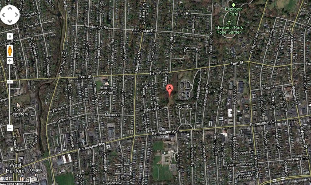
It also includes a stop in Vanderbilt Park, a little-known enclave accessible through a connector at the end of Edmund Place.
Here is the route Franklin came up with this summer. It's also available as an attached PDF, so you can easily print it and try it out.
Discover West Hartford By Bicycle – August 25, 2012 (18 miles +/-)
- Exit Town Hall Parking Lot – turn right on Raymond
- Cross Boulevard
- Right on Park
- Left on Overbrook (veers to the right and becomes Chamberlain)
- Left on Mayflower (optional detour through Trout Brook Park behind ECC)
- Right on New Britain
- Left on Somerset
- Right on Elmfield
- Left on Knollwood
- Right on Barton
- Left on Downing
- Right on Greenhouse Boulevard
- Through connector
- Straight on Shephard
- Right on New Britain Avenue
- Right on Clover
- Right on connector after house #47
- Left on Red Top
- Left on Burnham
- Right on Elmfield
- Left on Chatfield-cross New Britain Avenue
- Straight on Berkshire Road
- Right on Foxridge
- Right on Belcrest
- Left on Westminster – cross Sedgwick
- Straight on Lemay
- Right on Farmington
- Left on Pleasant
- Right on Whitman
- Left on path through Fern Park
- Left on Fern Street
- right on Fernbel
- Left on East Maxwell
- Right on Gallaudet – through connector
- Right on Cliffmore
- Left on Fox Chase
- Right on Asylum
- Left on Harvest – through connector
- Right on Flagg
- Right on Blue Ridge
- Right on Asylum
- Left into Bugbee School – through connector
- Left on Cliffmore
- Left on Brookside Place
- Right on Fulton
- Right on Main
- Left on Clifford--stay to the left at bottom of hill
- Left on Fox Meadow into UCONN Branch parking lot
- Right on sidewalk after Info Technology Center sign
- Stay right on sidewalk toward Trout Brook Drive, keep pond to the left
- Cross Trout Brook Drive at cross walk
- Right at Parking B Area sign, right then quick left in parking lot
- Cross wooden bridge, right n path through UConn baseball fields
- Left on Asylum
- Right on Ballard
- Left on Middlebrook
- Right on Steele
- Left on Birch, then left on Walbridge in to Elizabeth Park – stay to right
- Left in front of Pond House Restaurant
- Right on Asylum
- Right on Prospect
- First right into Elizabeth Park – follow the road in the park clockwise
- Left in front of Pond House Restaurant
- Left back on to Walbridge
- Right on Bainbridge
- Left on Foxcroft
- Left on Fern
- Right on Edmund Place – to end – through connector into Vanderbilt Park
- Right on Frederick
- Left on Lilley – cross Farmington Avenue – becomes Maplewood
- Right on Kingswood Road
- Left into Kingswood-Oxford School parking lot
- Right at sidewalk after Nicholson Building
- Right after Roberts Center – down ramp – stay to right around Roberts Center
- Exit Kingswood Oxford School at Memorial Drive
- Cross Trout Brook Drive – on Memorial Drive
- Left on Raymond
- Right into Town Hall Parking Lot
Get more local news delivered straight to your inbox. Sign up for free Patch newsletters and alerts.


