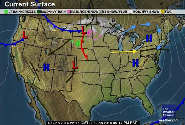
Earlier this week I promised to show you signs of when a cold snap is going to break. Tomorrow (Saturday) afternoon, the cold snap we are experiencing now will start to break. The big blue H located just to our north is the source of the cold. That back door cold front I mentioned a few days ago, the remnants are sitting to the south (see the yellow arrow pointing at it). It moved farther south than expected so snowfall totals indeed were higher south but you had to get to the CT coastline to see dramatic increases in the totals. Back to our high pressure friend: Because it has a clockwise rotation around it, frigid air is being imported from Canada (see the blue arrows depicting the air-flow direction). As the high drifts east overnight, we will pick up a southerly wind flow and immediately see signs that the cold snap is breaking. What to look for: You will feel the winds shift to a southerly direction. That is the first sign. As the day progresses tomorrow, you will see more haze (ozone) appear on the horizon. That is a strong sign that the cold air is being displaced. you also might see some thin clouds obscuring the sun a bit. Look for those signs after noon tomorrow and you can feel good that warmer air is on the way.