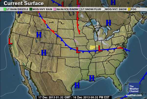
One of my favorite weather events is happening tomorrow. Its called an Alberta Clipper. A 'Clipper' is a winter-time storm that shoots across southern Canada and the northern USA from west to east. It is typically associated with calm winds and very cold temps (below 27f). Tuesday's snow event is a Clipper. Clippers are easy to forecast and (usually) very predictable. The result is a light to moderate snow event with idyllic picturesque snow covering virtually everything. The absence of winds means that even the smallest of branches will hold the snow so late tomorrow and early Wednesday could make for some really pretty sights. Another thing to know about a clipper is that the snow generally comes down at a reasonable pace so accumulations aren't so fast as to cause hazardous conditions. Yes, the roads will be slippery but road crews can usually easily keep up so sorry kids, I predict there WILL be school tomorrow. Here is a chance to go over a couple of weather terms you might commonly hear but don't know what they mean but should. For Tuesday, there is a Winter Weather Advisory in effect. The technical definition of this is for at least four and up to six or seven inches of snow within a 24 hour period starting within 12 hours or so. There is a winter weather advisory for tomorrow (Tuesday) from 6:00 AM until 5:00 PM. A Winter Storm Warning means a more serious weather event is taking place. At this point, there are no warnings issued for CT nor do I expect any. One thing to watch out for: On very rare occasion, a clipper can pick up a little energy from the Atlantic Ocean and result in a higher-than-forecast snowfall. In December of 1993, a clipper forecast to produce five inches actually dumped nearly 17 inches in many parts of the state so it is always advisable to keep the radio on in case the storm picks up unexpected energy. The attached picture is a Current Weather Map from their web site. You can see the snow over the Great Lakes. It is moving east and will arrive at dawn. One last comment for this and all future posts: Only NOAA (the National Oceanic and Atmospheric Administration) names storms and currently, only Hurricanes are named. I will not recognize named storms on here unless named by NOAA. Those storms only occur between June 1 and December 1 each year.