Health & Fitness
Snow with a capitol L
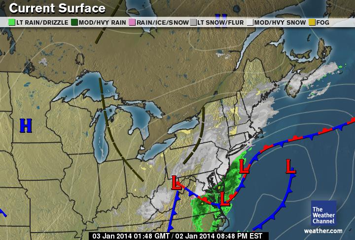
West Hartford remains under a Winter Storm Warning for about the next 12 hours. Snowfall has been surprisingly light thus far as the stronger bands stayed to our south and west for most of the day. This is the result of four low pressure systems that are in the process of combining into a one-two punch event. The first event was last night into this afternoon and the main event is starting now. One thing that is happening is the winds have really kicked up. This might be a good time to define what a blizzard is, because when all is said and done, we might succeed in achieving the threshold to call this storm a blizzard. The definition is a bit simpler than folks realize. It is for a sustained period of moderate to heavy snow combined with sustained winds of 35 mph or greater. I think we are close on the winds in West Hartford right now and if snowfall rates pick up, we will certainly cross that threshold sporadically at least over the next nine hours. What does this map show: The westernmost 'L' is in the process of transferring its energy to the primary center which is located over the Chesapeake Bay area of the mid-Atlantic and moving north and east. Once that is done, snowfall rates will increase significantly (it is already happening over Cape Cod and parts of Long Island) and we may just get a minimal blizzard out of this storm yet. The storm will intensify quickly and move up the coast and out to sea. More tomorrow.